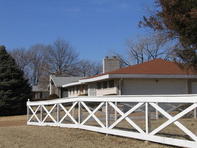
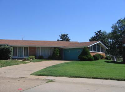
Guess where the picture above was taken: Ballwin? Florissant? Mehlville?
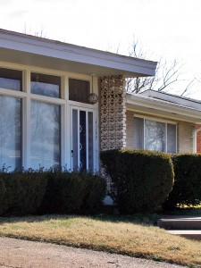
When faced with low-slung, stylish 1960s ranch houses casually strewn amongst profuse greenery, these would be valid guesses. But instead, we are exploring Norwood Square in North St. Louis City.
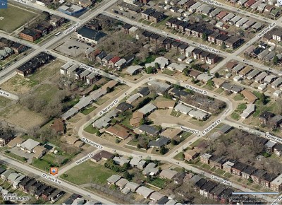
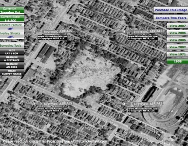
Norwood Square is actually a court (as shown in the aerial photo above), a half block northeast of the intersection of Union Boulevard and St. Louis Avenue in the Arlington neighborhood. And it doesn’t take a bird’s eye view to get the feeling that a giant scoop of the city grid was whisked away by a mega melon baller.
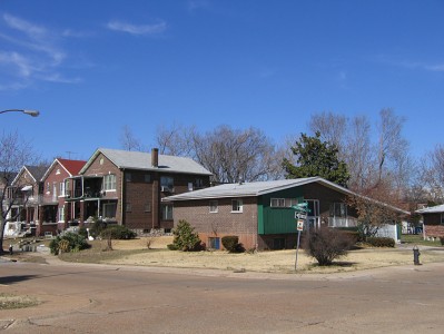
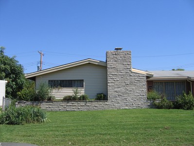
On the ground, it is rather dramatic to see rows of deeply urban, 2-story brick residential buildings built between the 1890s – 1920s abruptly bisected by a swirl of deeply suburban, mid-century modern frosted sugar cookies. As you fleetingly catch glimpses of the original natives from inside Norwood Square, it feels like the ranch homes are circling the wagons ’round to protect their fabulousness from hostile forces.
This mirage of displaced MCM sweetness is cited as the last new housing built in this part of North St. Louis. City record show that these 40-odd homes were built between 1961 – 1974, with the bulk of them going up between 1961 – 1966. They range from 982 – 1,888 square feet, with a median square footage of 1,450.
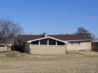
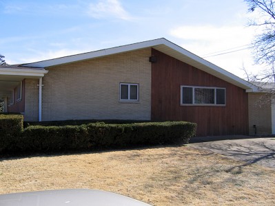
The circle that is Norwood Square is divided into East, West, North and South Norwood, which puts 4 of the houses (like the one above – which cleverly wraps its footprint around the curve) in the odd position of not knowing exactly which street they are on! Is their mailing address North Norwood or East Norwood, and how confusing is it to new mailmen on this beat?
So what’s the story with Norwood? Why was this exotic dollop dropped here, and what was torn down to make that so?
Having been told stories of Public Schools Stadium, I wondered if Norwood Square is what popped up in its place. But the stadium was a block east of here, on Kingshighway, and when it was demolished in the late 1960s, most of Norwood Square was built and firmly inhabited.
Noticing that a few of the homes have some serious sink issues, I wondered if it was built atop the quarry that was supposedly shut down sometime in the 1940s because some kids accidentally died while playing there. But no. The memories of some old school North St. Louisans’ remember the quarry at Kingshighway and Lexington, a good 2 blocks north east of here.
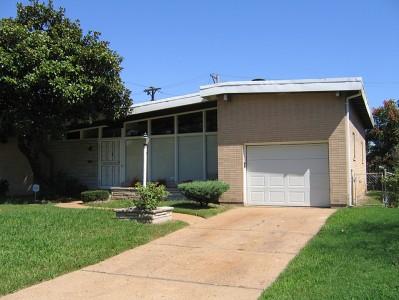
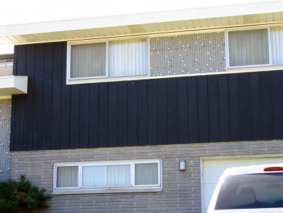
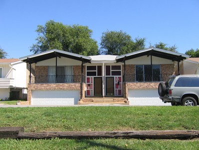
So, for now, the why it appeared and what disappeared to make it so remains a mystery. Please do share any historical information you may have in exchange for the details I share with you here. Like the snazzy tile work that graces this split-level, above.
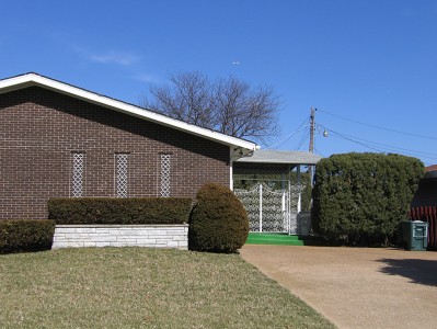
Or the swanky pendant light fixture and concrete block screen of this entrance.
From quick visual inspections over the course of several years, most all of the homes are still in good condition, always the sign of well-liked buildings. Many of them (see above) are meticulously preserved and cared for, a heart-warming sign of intense pride in their ranch house alien. Only rarely have I seen for sale signs on the yards, so I wonder if there might still be a hefty amount of original owners in tow, or a lot of kids inheriting them from the folks.
This home is the equivalent of the half man/half woman Halloween costume!
To see more photos and details of Norwood Square, please visit the B.E.L.T. supplement at Flickr.
Facing out onto St. Louis Avenue, like sentries protecting their MCM turf, is a short row of 2-family versions.
The chalk and cheese concept of Norwood Square is not wholly unique. Something similar was done in South St. Louis with Marla Court. Or there’s Darla Court in the inner-ring ‘burb of Jennings. So, it’s not uncommon, but it’s always a pleasant surprise, yes?
UPDATE
Steve Patterson – who first told me about the subdivision several years ago – sent along this aerial map from 1958. Seems the street grid was long interrupted in this part of town, and look at all those mature trees! This would also bear out the info Rick Bonasch shared about the original site being a dump.

I’ve been researching one of the properties in this subdivision, and I found that this site was a quarry prior to being developed as Norwood Square. There were at least two quarries in this part of St. Louis, so this one existed alongside the one mentioned in this post by the author. St. Louis County has historical aerial imagery on their interactive mapping website dating back to 1937 that shows the quarry (https://data-stlcogis.opendata.arcgis.com/app/historic-aerials). I also corroborated this information with the Sanborn Fire Insurance Map from 1908, which depicts a quarry occupying this location. St. Louis City Directories from 1922 list Bambrick Brothers Construction Company as owning the lot. A detailed description of the operations at the historic quarry can be found at https://quarriesandbeyond.org/states/mo/mo-quarry_photos_21_a.html. As many of the other commenters have pointed out, dumping probably did happen in the interim, after the quarry was decommissioned but prior to being developed as Norwood Square.
Leslie, thank you so much for checking in and sharing your story. I know exactly which house you’re speaking of (it’s superb), and that your father stayed so long and tried so hard to fix the unfixable is a testament to him and the beauty of the neighborhood. You’ve inspired dozens of questions – peak curiosity!
There are a few “new” MCM neighborhoods in the North St. Louis, like this one: http://www.beltstl.com/north-st-louis-mcm-north-cote-brilliante-subdivision/ . I wish I could hear more of those family stories. The post-WW2 housing boom story is always told from a white suburban perspective, which conveniently leaves out redlining and new homes built within the city boundary. So thank you shining a quick light on other chapters of the story.
My parents Charles and Melvanah Lee built the house at 1560 South Norwood Drive in 1962 and my father lived there until 2013. During the time of redlining, my parents were able to build a modern ranch in the middle of north city among upwardly mobile dentists, engineers, physicians, business owners and teachers. All of the homes were ranch style, or split level some sporting swimming pools which you could see when flying over the city. I was always told that the site was a city dump that had been cleared and excavated. Unfortunately the soil was not well compacted on some of the lots resulting in extreme settling. Twice my parents had steel peering put in to reinforce the settling foundation but to no avail. They even attempted to sue the developer or the property but the company had declared bankruptcy. I have wonderful memories growing up in the house and in the neighborhood but over the years the continued settling of the house rendered it unlivable for my father whom I moved into assisted living. What a delight to find information on the neighborhood my family once loved so very much!!! Thank you.
Pingback: Norwood Square in North St. Louis City - Modern STL
This building on a dump site seems to be something that was done a lot. There was a dump across the street from where I grew up in S. city at Eugene and Robert (south of Carondelet Park). I believe 4 houses were built there in the 50’s. Also another larger dump on Koeln had a subdivision built, Alaskan Court. Eventually because of the horrible settling the houses were torn down and it’s now a park. They were ranch style some of the houses tilted so badly their roofs were thisclose to touching. Also I heard of people actually having to nail their furniture to the floor to keep it from sliding, tubs that wouldn’t drain etc. Really cute little houses, a real shame. Just goes to show you can’t build on a dump that was filled with mostly paper etc.
Hmmm… that might also explain why some of them have only half a basement? Thanks for the info.
St, Louis architect, native, and Wash U graduate Karl Grice grew up on St. Louis Avenue, not far from this site. I asked him about it, and this is what he said.
Karl’s dad worked in construction. This development went up when Karl was very young. According to Karl’s dad, it was built on the site of a former dump.
That’s why there’s so much settlement.