September 24, 2005
The last visit was September 4th, 2005. The entire chronological saga is compiled here. Also, by clicking on them, all photos enlarge for better viewing.
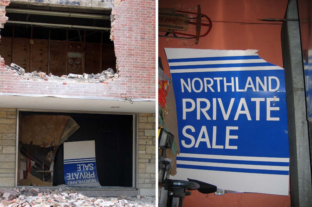
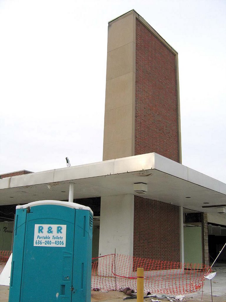
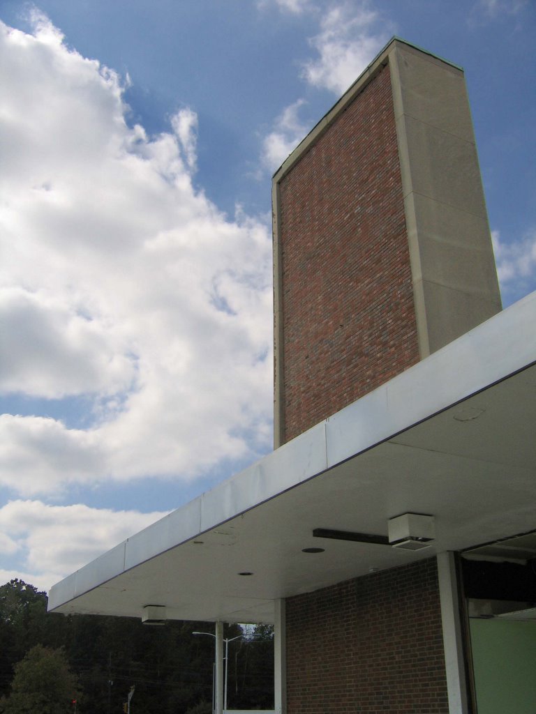
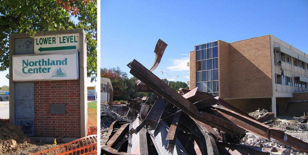
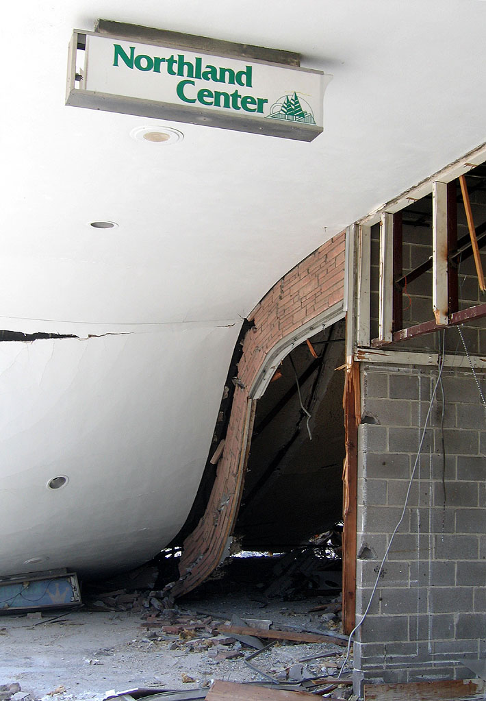
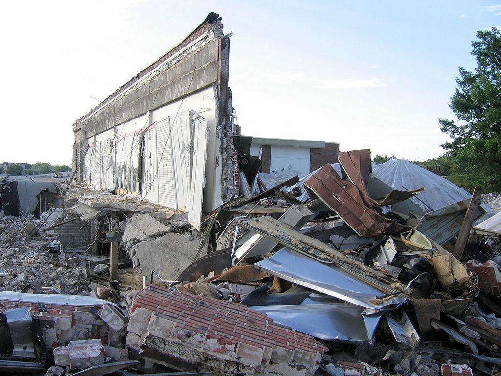
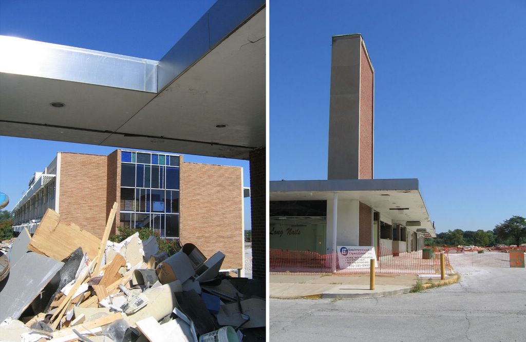
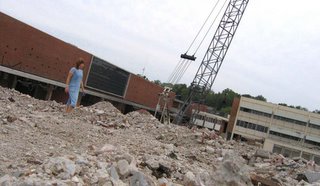
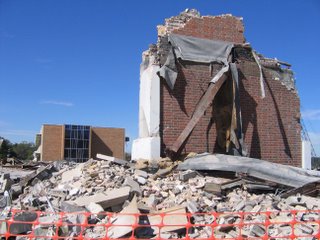
 After a 3 week absence, I was shocked to see the tower (above) still standing. But the demolition crew had moved their Porta Potties, so they were ready to get serious about crushing the southern upper level.
 Circling around all sides of the tower (above left & right) was an odd sort of Maypole dance.
 In preparation for the final crush, the Walgreen’s sign was uncovered (above, left), and capturing this Mondrian-esque sight (above, right) made me nostalgic for when Walgreen’s had a killer liquor department. It was one of my favorite places for last-minute Christmas stocking stuffers. But in the late 1990s, the Mormons reportedly bought the corporation, and they banned the booze.
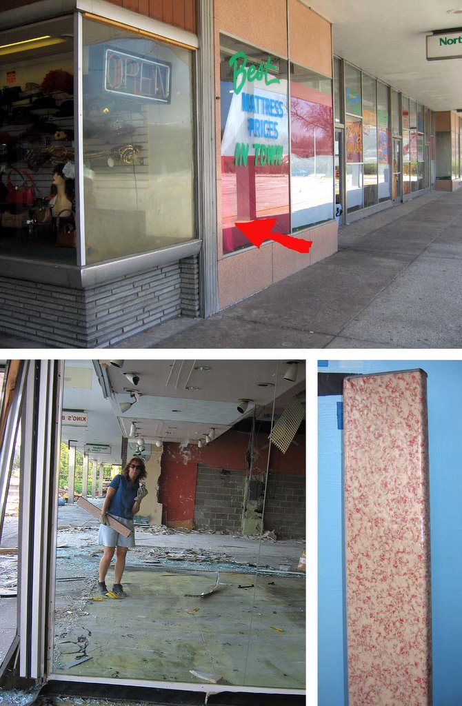
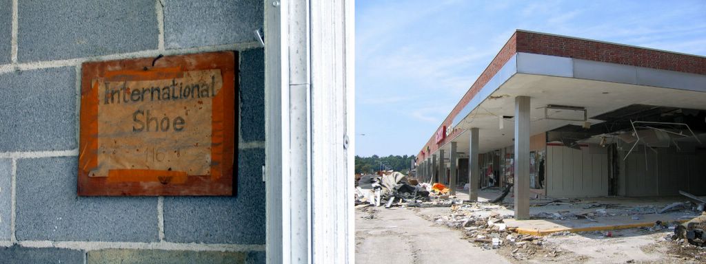
 7 doors north, all the glass was stripped from the former jewelry store, making it easy to take one last lap around the ravaged space (above, left). It also featured a hatchet edge (above, right) where I could stare straight down into the abyss that was once the Famous-Barr building and the entire north wing, upper & lower levels.
 Staring up from the lower level, the same jewlery store can be seen on the far left of the above, left picture. One normally only sees neat sections on building blueprints, but from this view, it was a section plan come to life. It’s a fascinating reveal of how the upper & lower levels worked, and how the wide array of facade materials formed a large, modern mosaic. Down at the West Florissant entrance to the Office Building (above, right), I got one of the last shots of the upper & lower level play of the south wing. With the plexiglass walls gone, it becomes a pure, unobstructed view of the basic, geometric building blocks that was the ingenious premise of Northland.
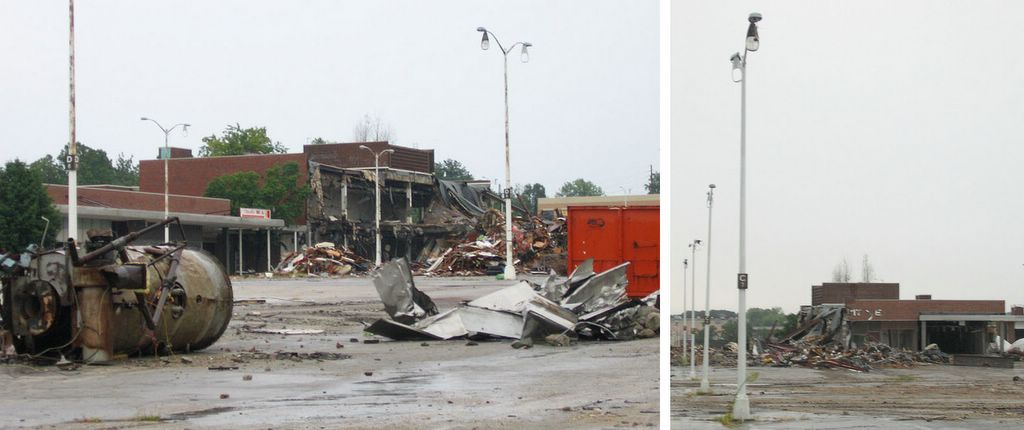
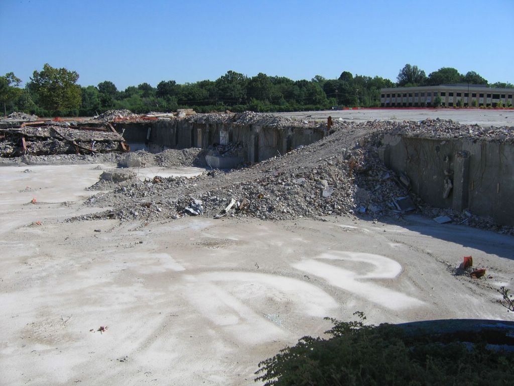
 The Rubble Mountain (above) was getting ever taller. Even though the concept of climbing the busted remains of Northland creeped me out, it was too unusual to let a self-timer photo opp pass.
No, I don’t usually spelunk demo sites in a dress. I’d come straight from work. And in my left hand are pieces of the stained glass from the Office Building (far right in the photo) exterior stairwells that were now available. A Scavenger Sidewalk Sale, of sorts.
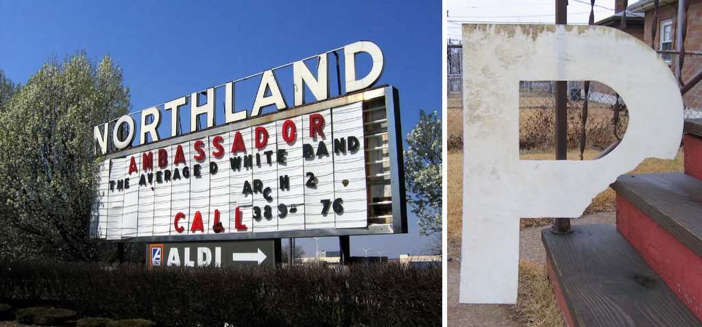
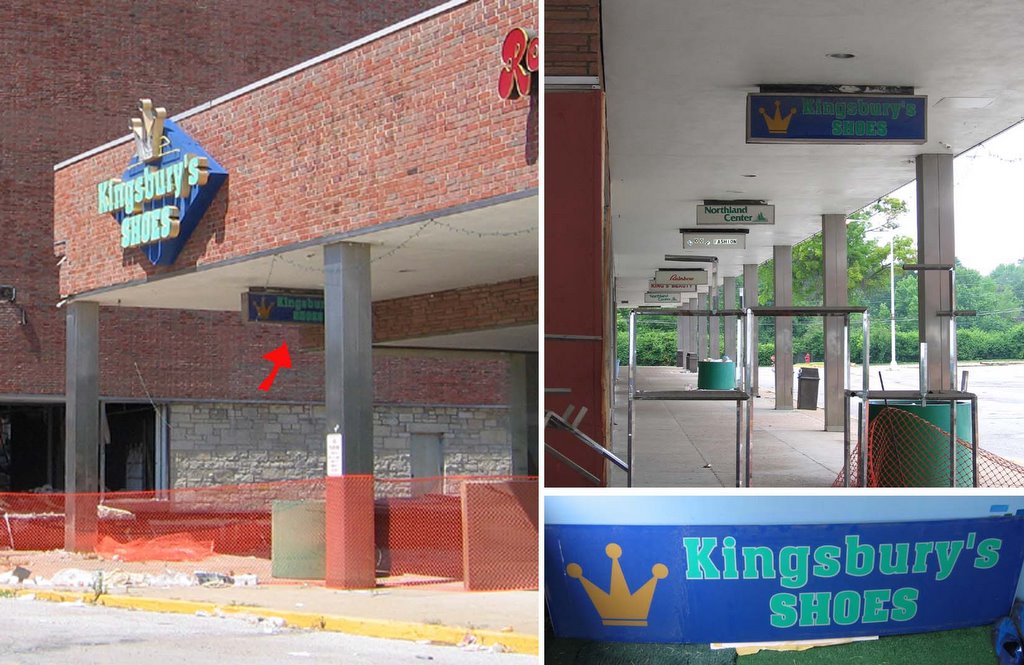
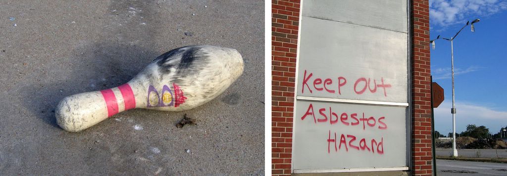
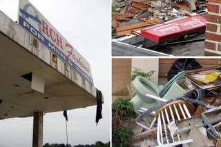 Here’s a small collage of uncovered signage and tossed toilets. I finally got an unobstructed shot of the Staten Island Cleaners sign (above, top right). When the dry cleaners vacated, a chop suey joint took over the space. It looks as if when they installed their own sign, they simply knocked the Staten Island sign over onto the roof.
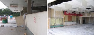
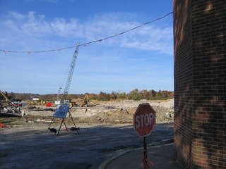
October 9th, 2005
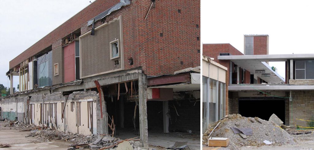
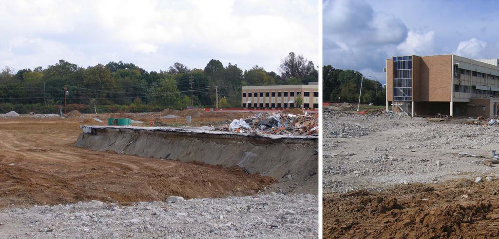
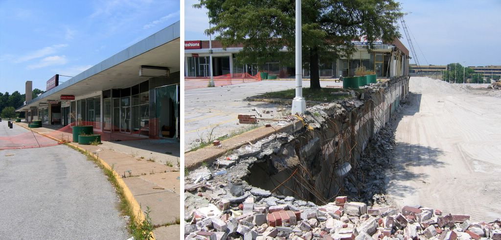
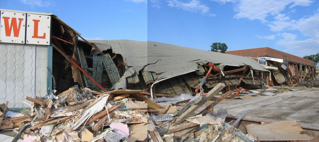
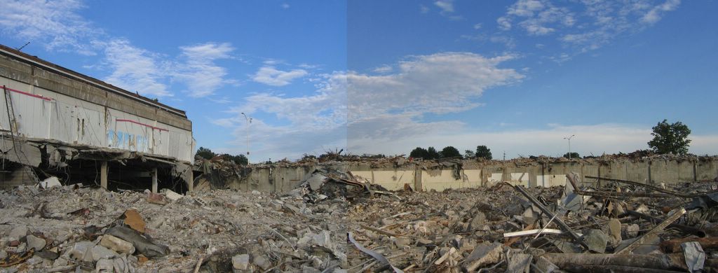
 2 weeks later, exactly half of the south wing has disappeared (above). And I zoom in on what the demo crew left behind when the closing bell sounded at Friday quitting time.
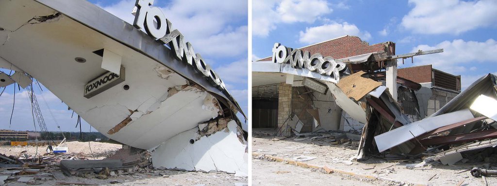
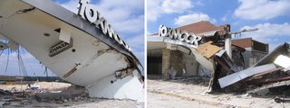 As sad as it is, there’s also beauty and grace within demolition scenes. Goethe said “architecture is frozen music,” but when its busted pieces are crashing and fluttering about, it thaws to become a sorrowful, minor key symphony. In the case of the Foxmoor storefront (above, left & right), it also felt like an action sequence that came to a halt when the film reel jammed.
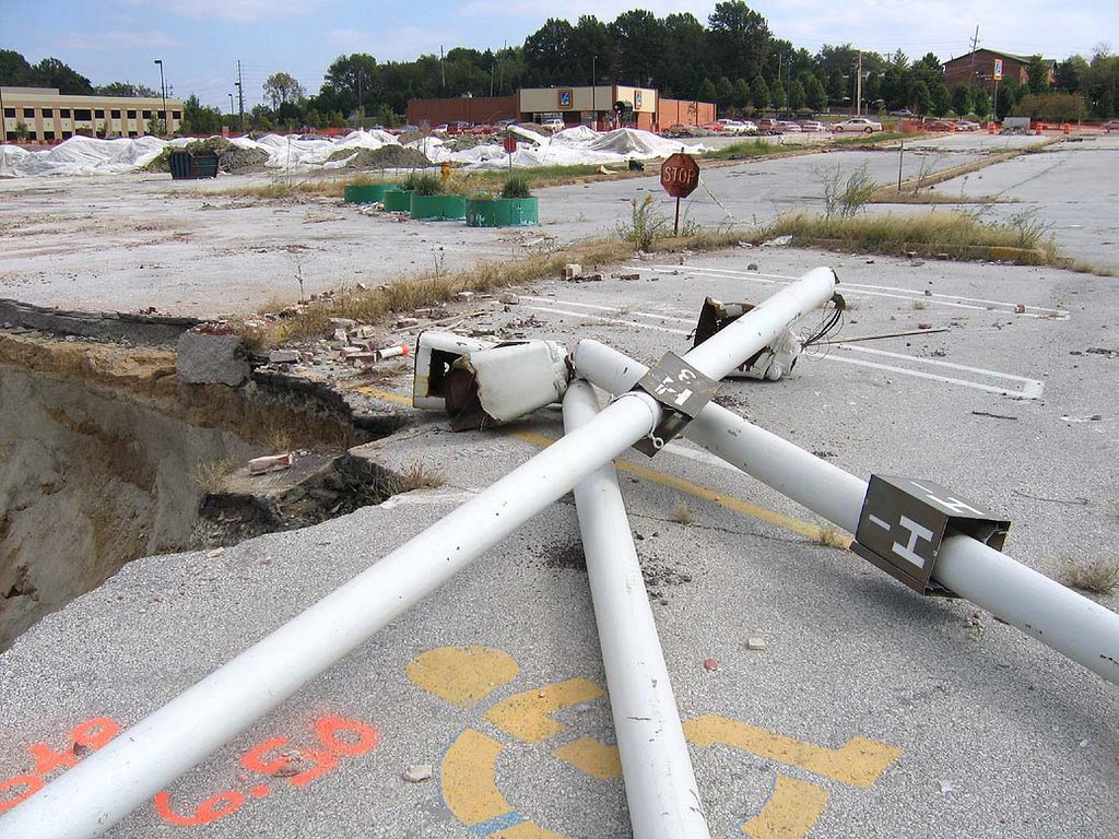
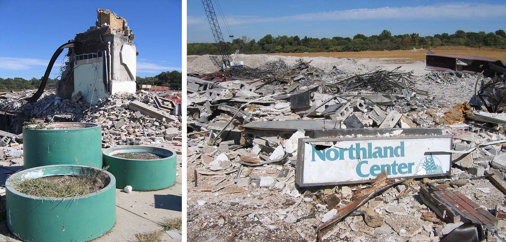
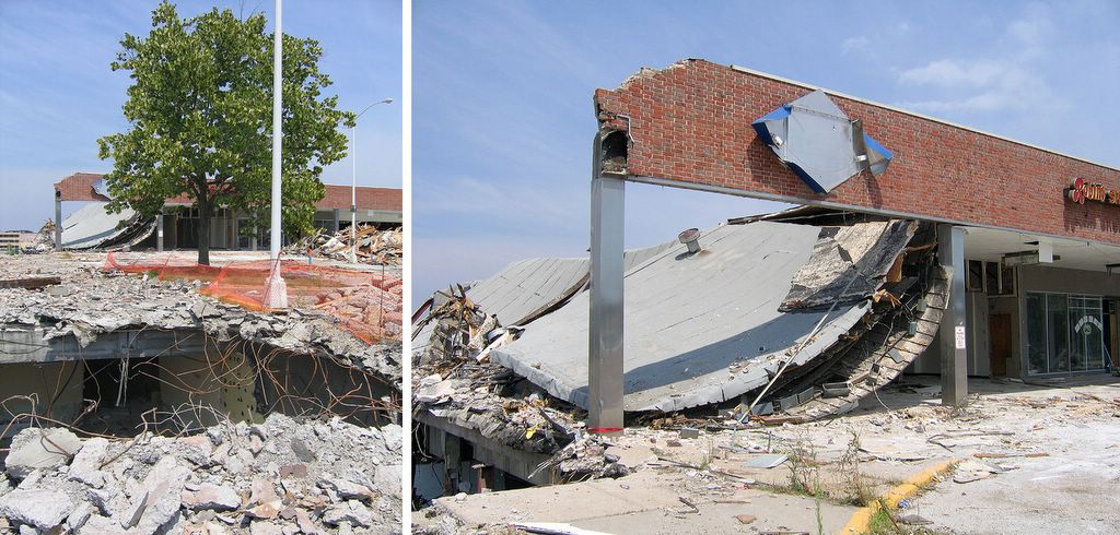
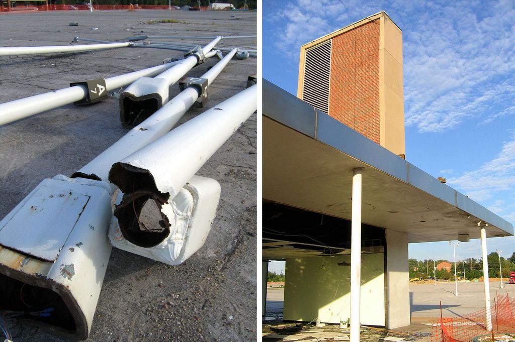
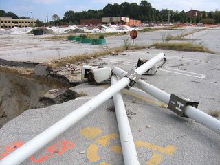 Or a giant’s game of Pick-Up Stix (above). The light poles just barely missed falling into the pit. Also note the 4 round green planters near the top center of the photo.
As the crews have methodically dismantled and cleared each space before crushing it, they carefully move these planters out of the way, rather than obliterating them.
 It’s so odd, for the crews have to physically move these planters from place to place. But it’s also comical, because the planters now resemble a Greek chorus traveling behind each new wound, pointing and contributing commentary. These planters have become bookmarks, or a perverse version of Where’s Waldo? as I crane to find them somewhere within each frame.
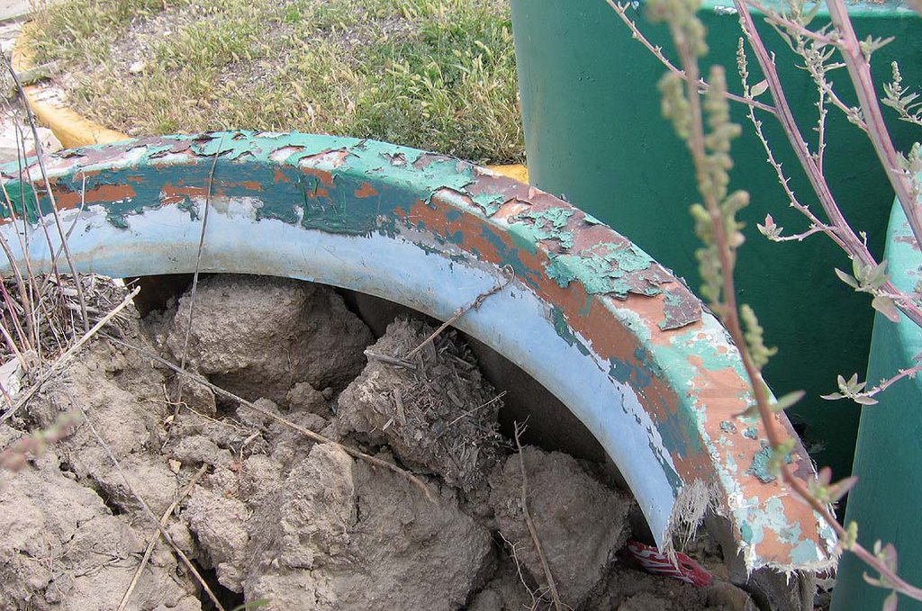
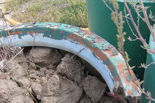
A close-up view (above) reveals about 5 layers of paint over the years, with the original layer being the light blue that dominated the Northland color scheme. Also, I always assumed the planters were made of concrete, but it’s actually a fiberglass & plastic mixture. This makes them relatively light-weight, and easy for the demolition crew to move about like checkers.
Hmmm…would I be able to move one from the site and into my backyard?
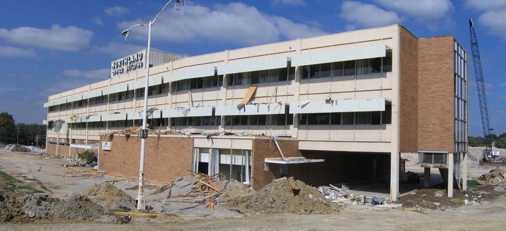
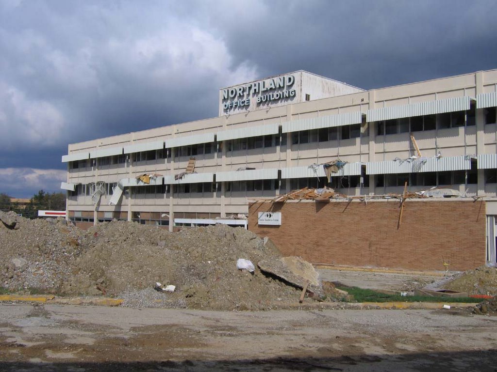
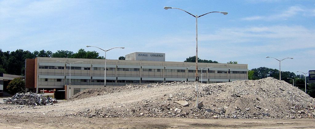
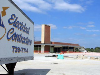
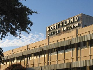
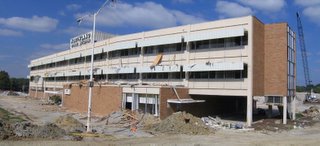 The Northland Office Building was wide open and prepped for the big crush…
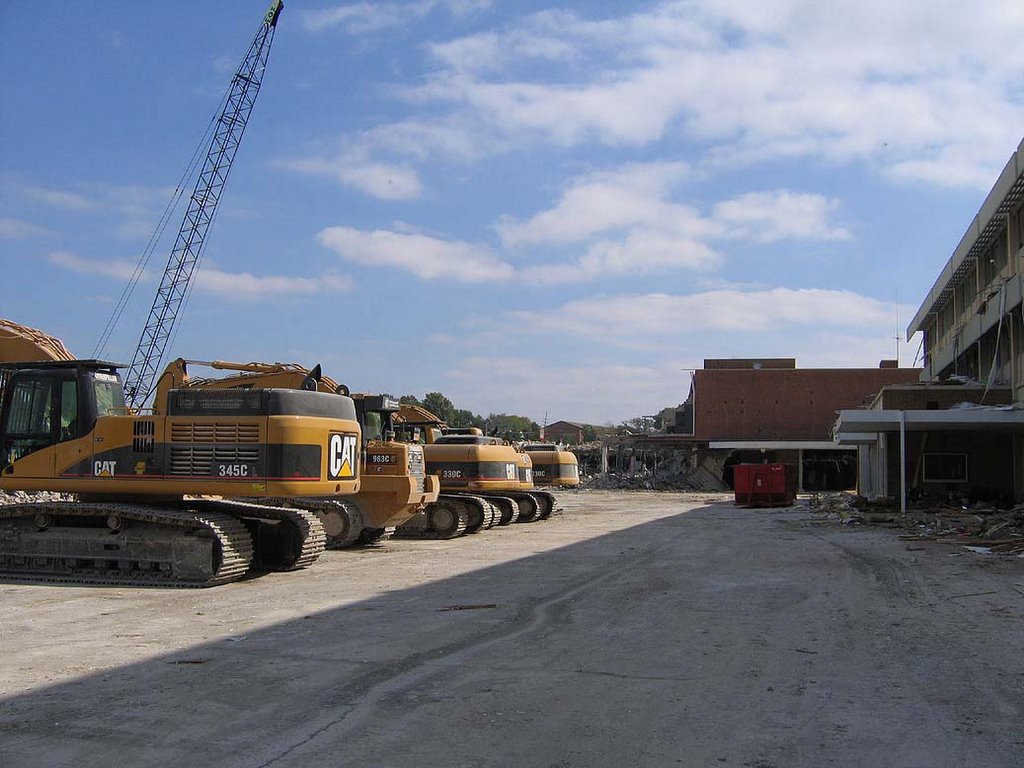
 …with machinery lined up to attack. So I figured I better get inside for some final detail shots before it was gone for good.
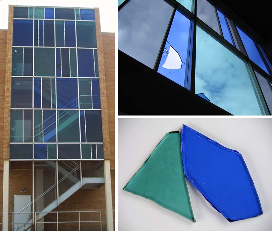
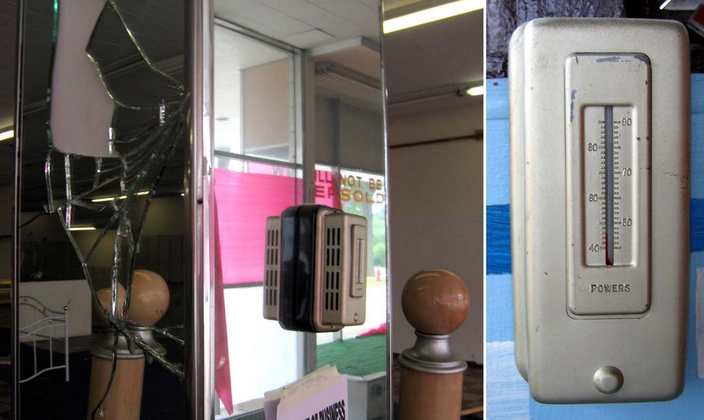
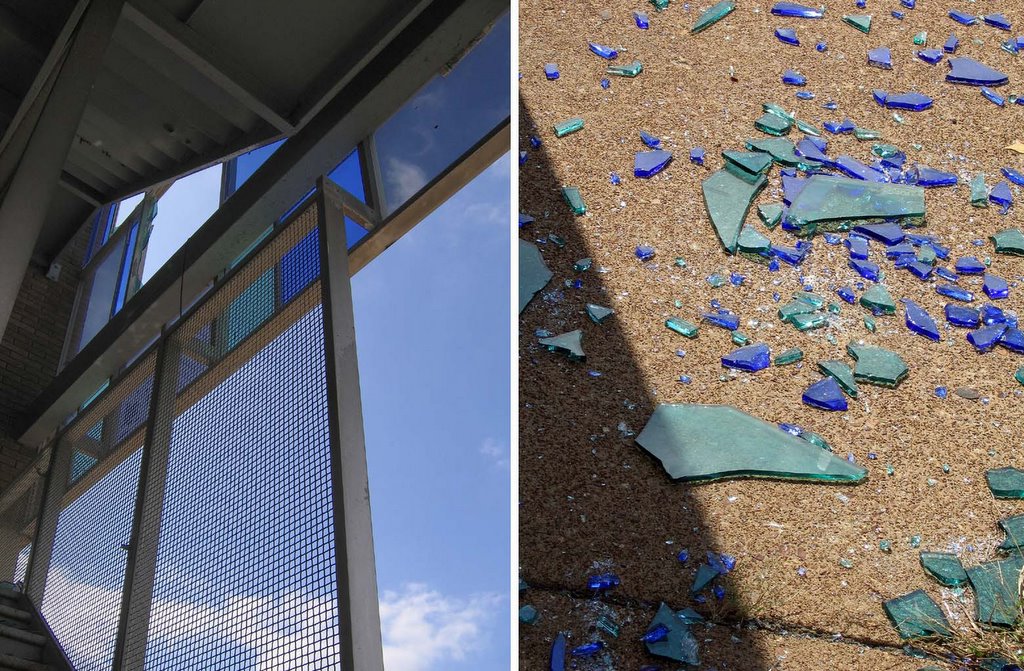
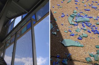 Even more stained glass was missing from the external stairwells (above, left), which left beautiful confetti on the sidewalk below.
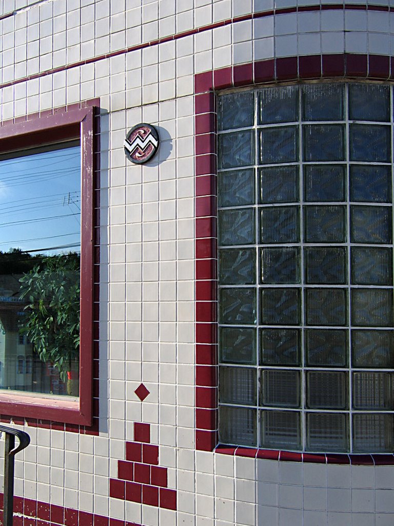
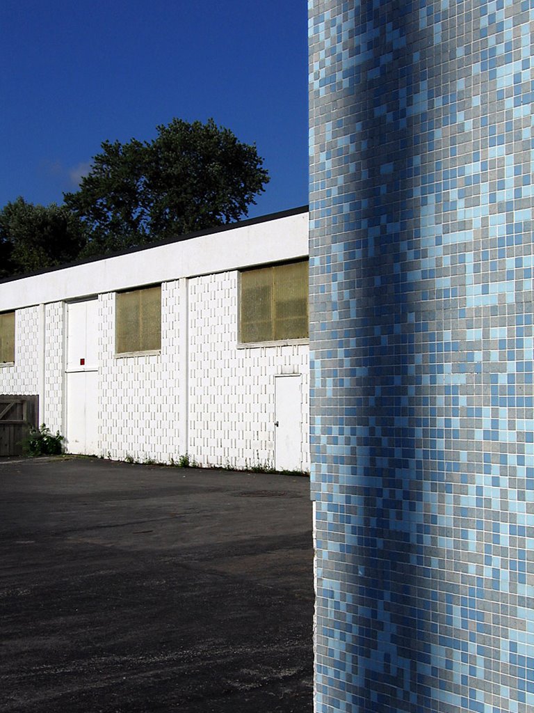
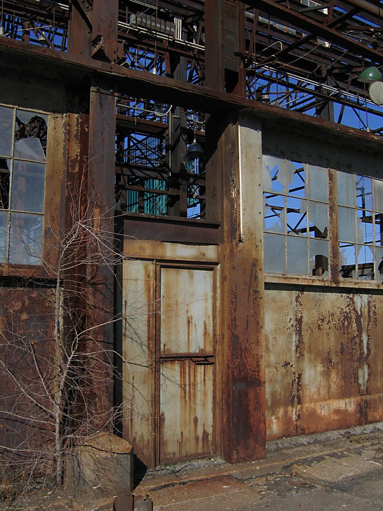
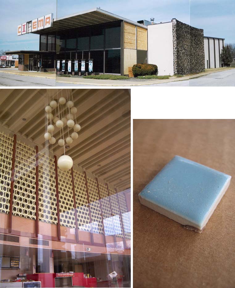
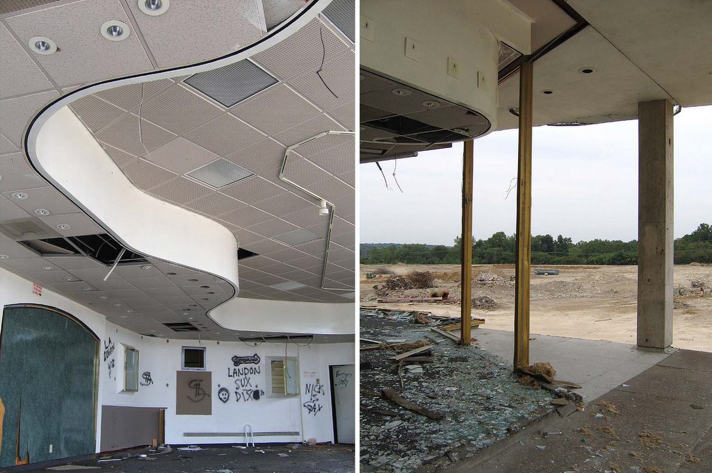
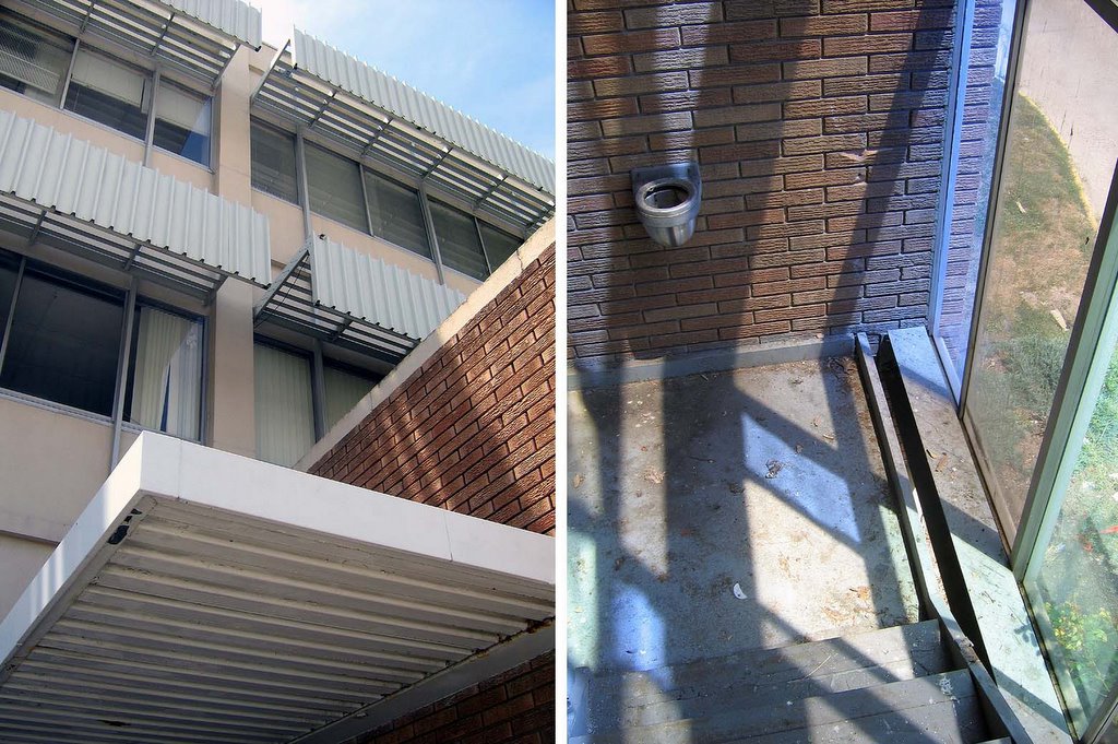
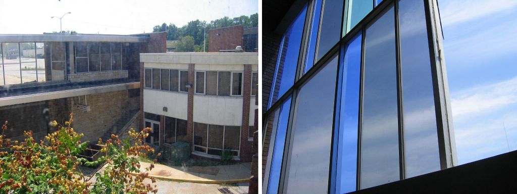
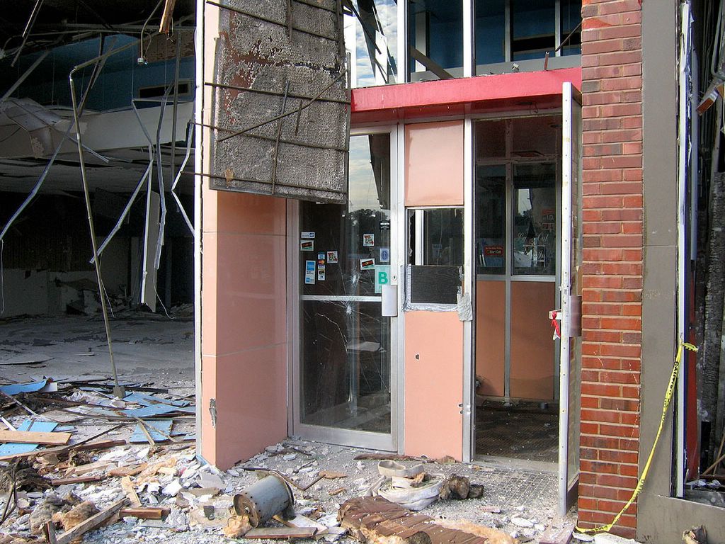
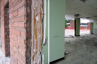
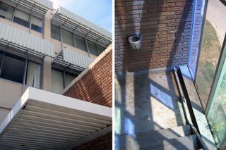
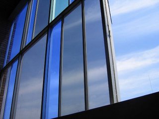
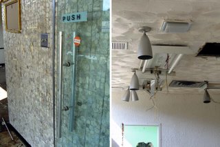 Coming in through the south-facing main entrance, I’m surprised at how much of the original finishes remain. There’s the simplistic handles of the glass doors against the space-age shaped mosaic tile (above, left) , and the goblet-shaped metal canister lights (above, right) that were prevalent in many commercial spaces during the late 1950s.
 Exit the building from the north-facing side (above, left) and head over for the last look at what remains of the south wing’s lower level (above, right).
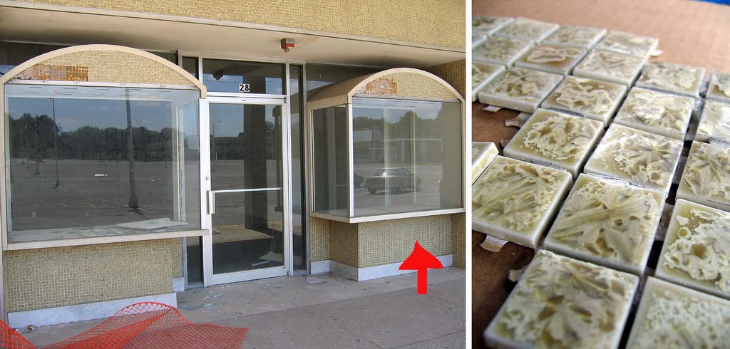
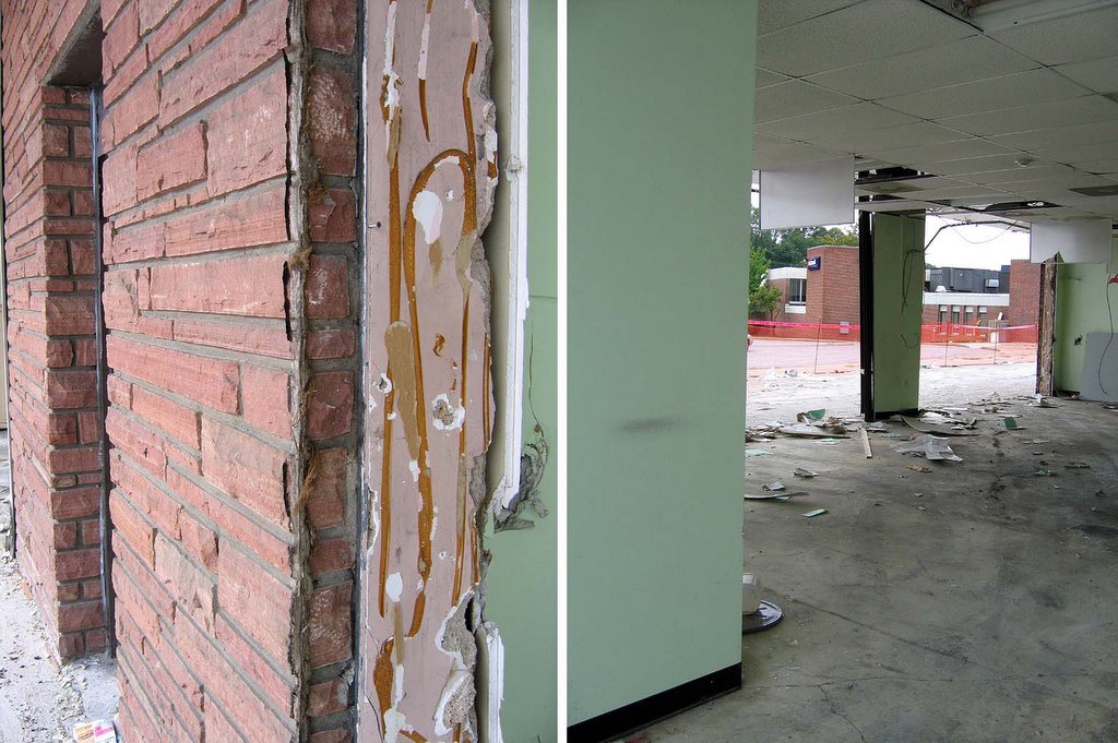
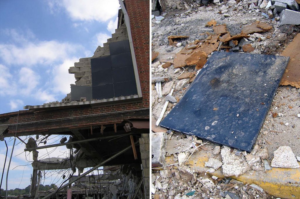
 I finally got to see what material had comprised the black rectangle (above, left), since they were now scattered on the ground. Each panel was metal covered in porcelain enamel (above, right), which surprised me. That material was recently out of favor for facades, with its heyday being the 1930s and ’40s. For the Northland architects to pick that material for use in a purely decorative manner was a nice touch.
Of course I tried to salvage one of the panels, but like everything at Northland, the pieces wind up being much, much larger than they seem from ground level. This single panel was about 3′ x 2′, and way too heavy for me to carry over a long distance. Since the site was completely closed off and torn up, I had to park at the stand-alone Blockbuster up near the Lucas & Hunt/West Florissant intersection and walk a bit to get to the demolition. While it never seemed like a long walk previously, carrying a 35-pound enamel panel would make it feel like a mile. So, I had to leave it behind. I still regret that, but then, where would I have put it?
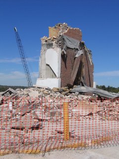
 Considering how fast the crew moves when they’re cleared for take off, I had a feeling this was my last moments with the tower (above). Actually, I was hoping it would be, because I was worn down by the anticipatory dread. But I was torn between wanting to capture parts of its demise, and just returning to see it completely cleared (like the grocery store) so I wouldn’t have to see such a grim sight.
October 16th, 2005
On this day, I turned 40, while Northland only made it a scootch past 50 years old. I hope there’s no symbolism involved here.
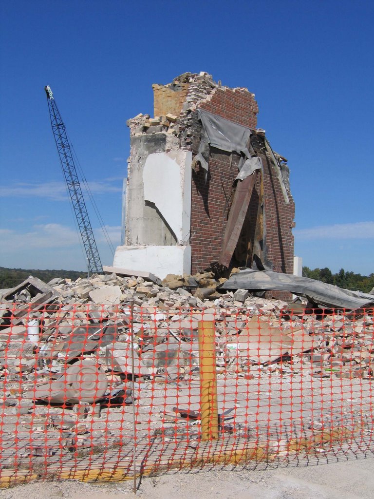
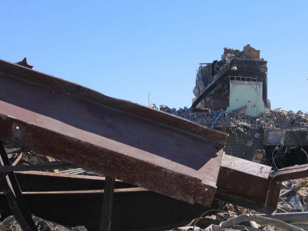
 And I caught the last gasping remains of the once-mighty-pretty tower (above). While the crew completely cleared everything immediately around it, they left just this last bit standing, almost as if leaving me a birthday present. Thank you…. I think?
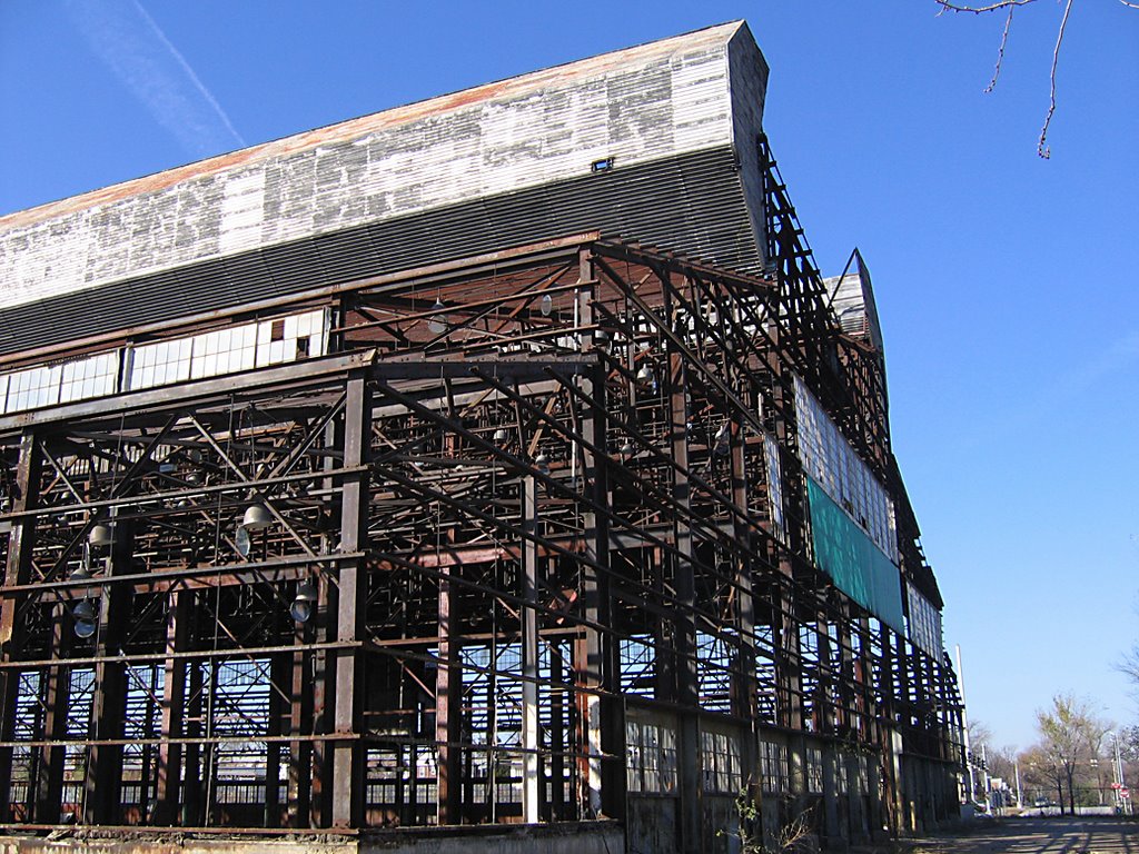
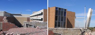
 But the Office Building still stands in the background (above). Which made sense when I pondered it; the demo crew is very methodical. They won’t crush the Office Building until they’ve completely cleared the last bits of the mall, proper. Environmental Operations, Inc. have been fabulously meticulous throughout this long, hard process.
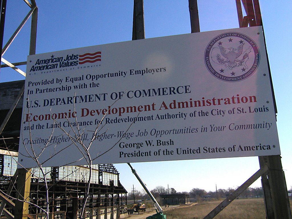
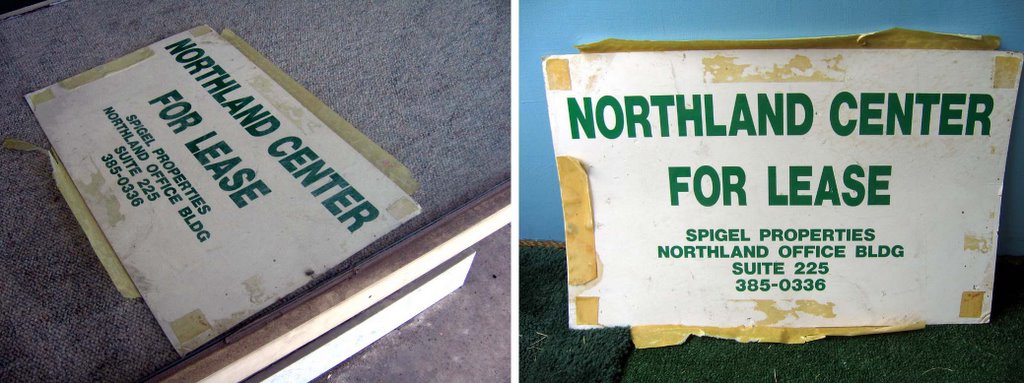
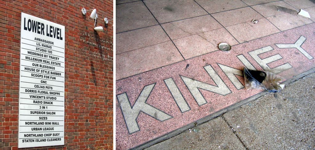
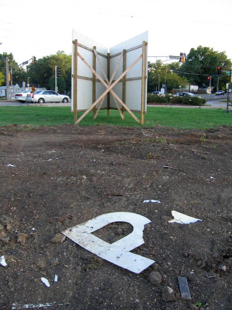
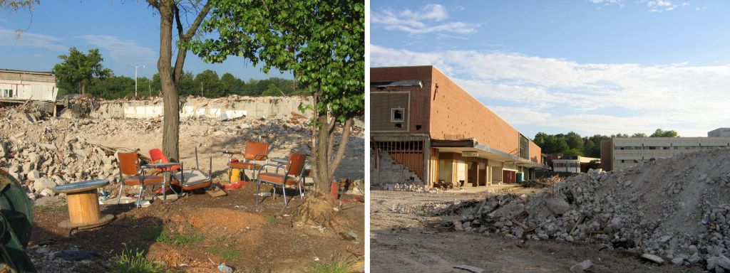
 The Greek chorus (above, left) moves to the southwest, to sing a final farewell to the tower, while trekking directly north of them, I find a sign (above, right) patiently narrating what all this rubble once was.
 Looking west at what was the stairwell to the lower level, the still-standing bank can be seen on the left side of the above, left photo.
Once there was a multitude of stainless steel columns, but now we have the Last Mohican (above, right). I tried my best to salvage any piece of the still-vibrant stainless steel, but the sections were either too long or too large to handle by myself, or were jutting out of piles that could have turned into a massively scary game of Jenga if I pulled incorrectly.
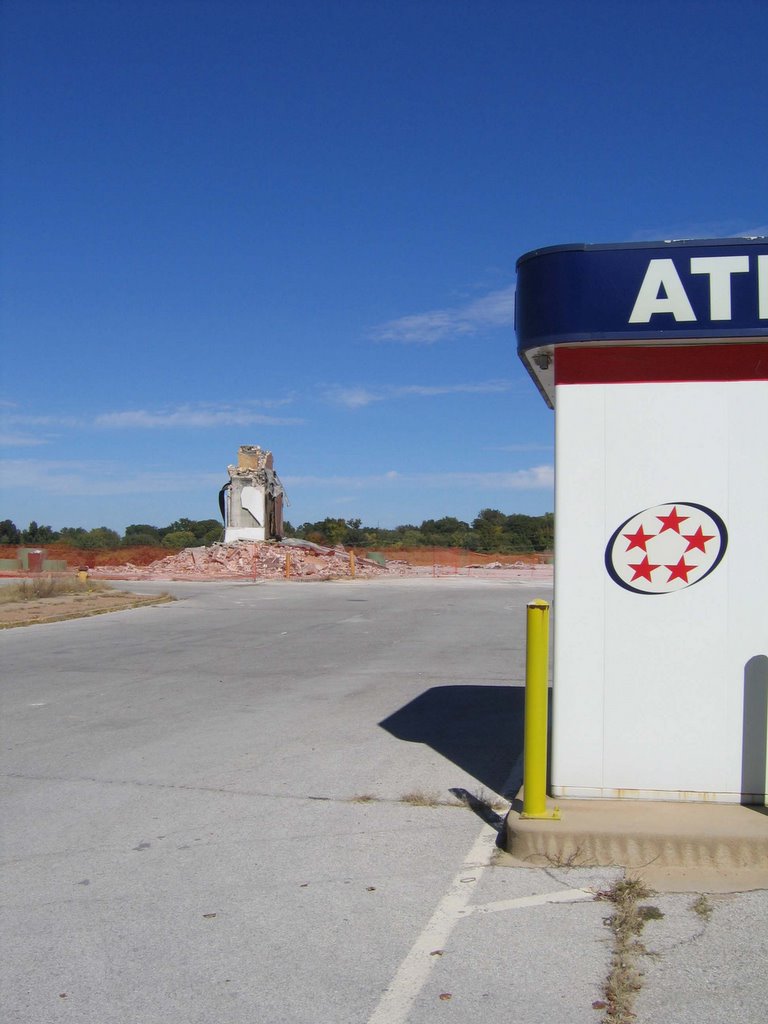
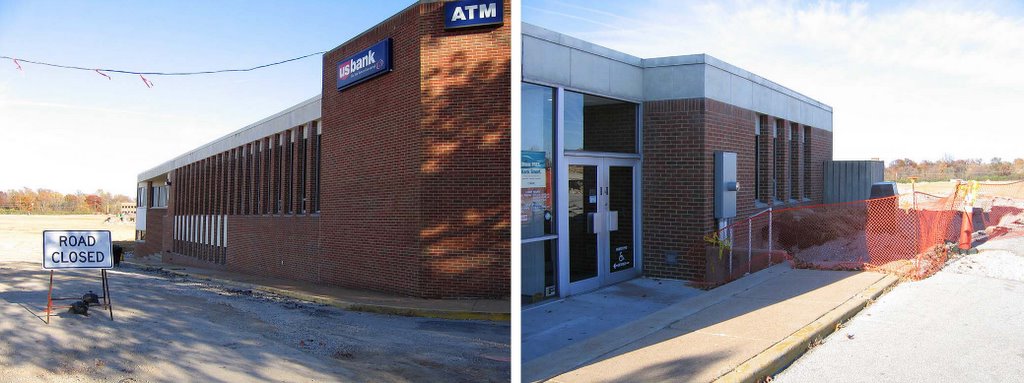
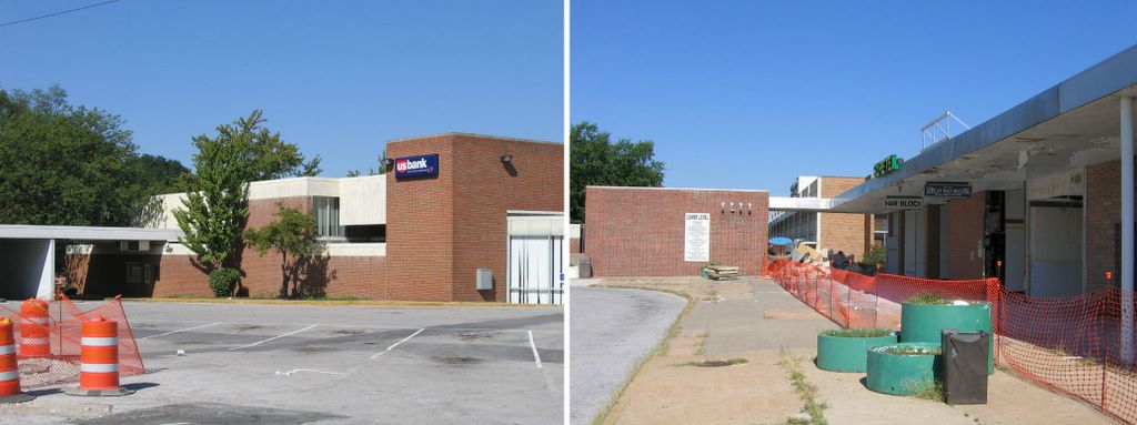
 Since the bank will remain open for the duration of the demolition and new construction, I shot one of the drive-up ATM kiosks as a future reference point (above). Once everything is demolished, spatial relations change drastically, and it’s difficult to pin-point what was where. By picking something that will remain, it’s easier to find the phantom spot in the future, should I wish to engage in morbid memories. But so far, I just want this to be over with.
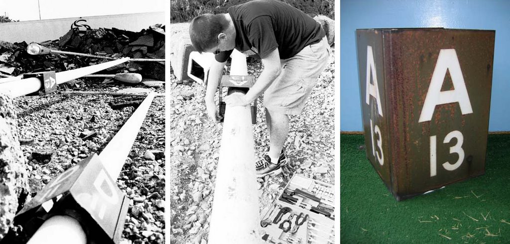
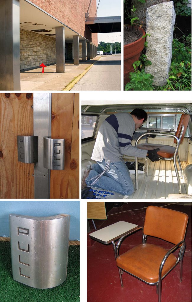
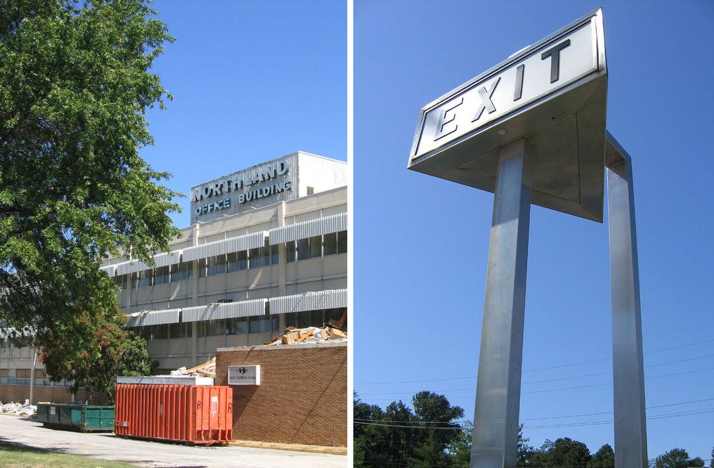
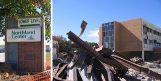 Save for the main one, all identifying signs (above, left) still ring the perimeter of the property. I’d love to get my hands one of those Exit signs, but again, they are really huge. I could get someone to help me cart it off, but then where would I put it? Turn it into a coffee table, maybe?
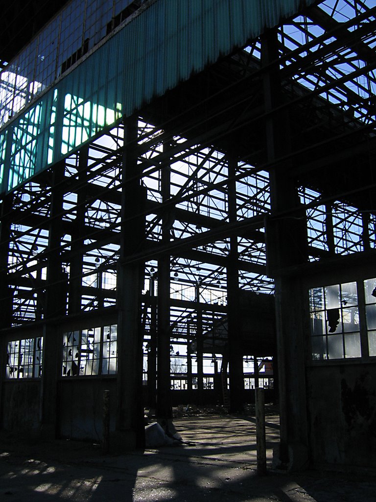
Above, right, standing in what was the lower level, and shooting through, and past, the iron framework. And it’s still a weird, creepy feeling to be standing on what was a solid building just days ago.
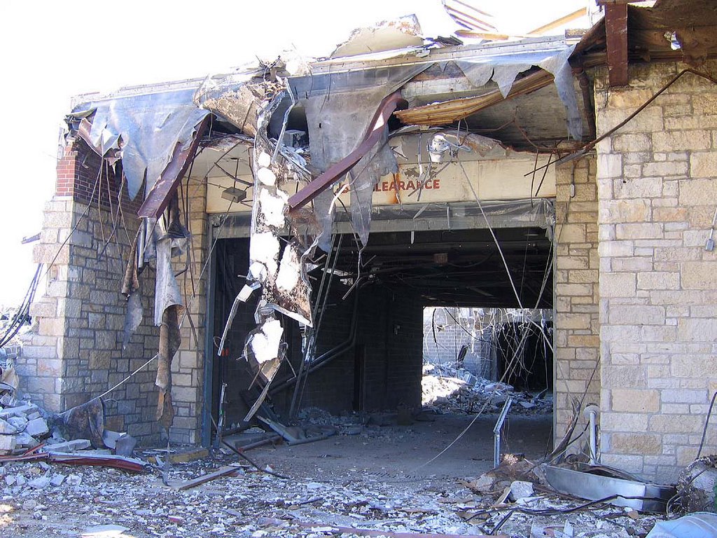
 This was the southern lower level shipping and receiving garage, which lead to an entire city’s worth of neighborhoods underground. I never realized just how massive this place was until they dismantled it. The dry cleaners/chop suey joint was to the immediate left in the (above) photo, the stairwell to the right. In the last years, one could always smell urine when walking past this spot. Now it has a brief chance to air out…
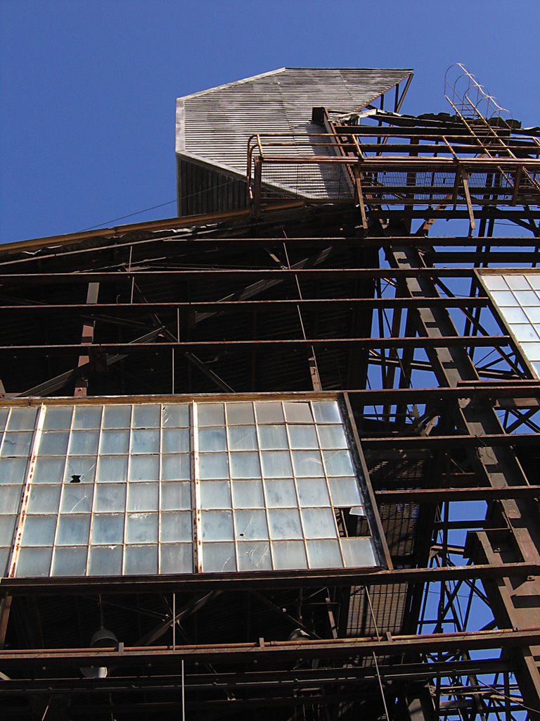
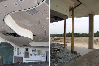
 Here’s the last of Northland’s 3 stairwells (above), which had been sealed off since at least 2002. And again, we see the plaster not so much falling off, but peeling off to hang like a curtain. It truly is an impressive sight. All that weight hung like that for another 2 weeks or so, which points out – yet again – how tightly and strongly this place was built. And which is why it’s taking so long to tear it down.
Which makes me think about the place that will replace Northland. In about 25-30 years from the date it opens, it will be crushed for some other new development, but at that time, demolition will only take about a month or so. Meaning, the advantage to building cheap, flimsy new buildings is the built-in demolition savings in the future. Very clever, that.
 From the lower-level pit, I look up for one final goodbye to The Tower, and then had to split for some birthday merriment. But it felt good to spend a little time with a place that has meant so much to me over these 4 decades of life.
October 24th, 2005
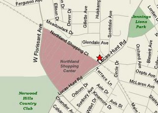 At the very north-eastern of the Northland property (see star on map, above), there was an organic, pedestrian-made foot path that took you from the top of the hill down into Northland, just behind the cinema. Many of us walked to Northland back in the day (I know I walked to more than was ever driven to), and many still do; every time I’ve been at the site, easily 20% of the folks I encountered were on foot.
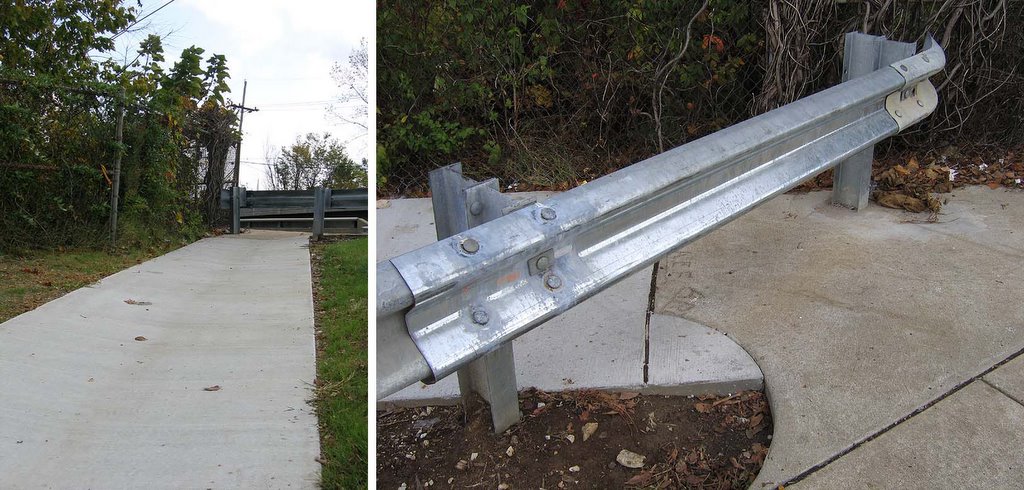
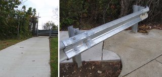 The new developers have acknowledged that path, and made it official by paving it (above, left). Nice touch, truly, because it shows they’ve acknowledged how people in the community have – and will – use the place. Then I get to the top of new sidewalk, and….
(Above, right). What the piss?! Some well intentioned but dunder-headed street department worker decided to cap off the metal guard rail! You can see how fresh it is, and how it violates the freshly laid concrete sidewalk! What were they thinking?!
Oh, they weren’t thinking, obviously.
Build an official pedestrian path, and then block it off…brilliant, just brilliant.
OK, the young can easily hop over it, but what about the old? And even as I photographed this jerk move, 3 little kids were riding their bikes across the Northland lot. They pedaled up the new sidewalk, and confronted the new roadblock. The 2 boys quickly got off their bikes, picked them up and over onto the outer sidewalk. Then they pedaled off, leaving behind the little girl, who couldn’t pick up her bike as easily.
Putting her bike on its side, she pushed it under the rail, then hopped over to pull it out the rest of the way. During the solid minute that she spent overcoming the obstacle, the boys had long-since disappeared, and she had to frantically pedal off to find them.
Either Sansone (the developer) needs to get over there and remove that end cap, or someone in the neighborhood needs to take a chainsaw to it. Either way, fix it!
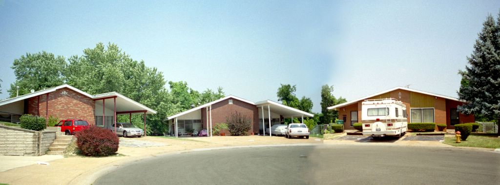
 Northland was a 65+ acre property, very hilly. My father tells of hunting rabbits on that forest-like property back in the 1940s. The original Northland architects worked with that landscape, creating a multi-level structure. The new development will obviously be one level, on flat ground. Looking north (above, left, and note the Greek Chorus in the distance), see that everything has been filled in. The demolition remains were packed down to form a foundation, and fresh dirt caps it off.
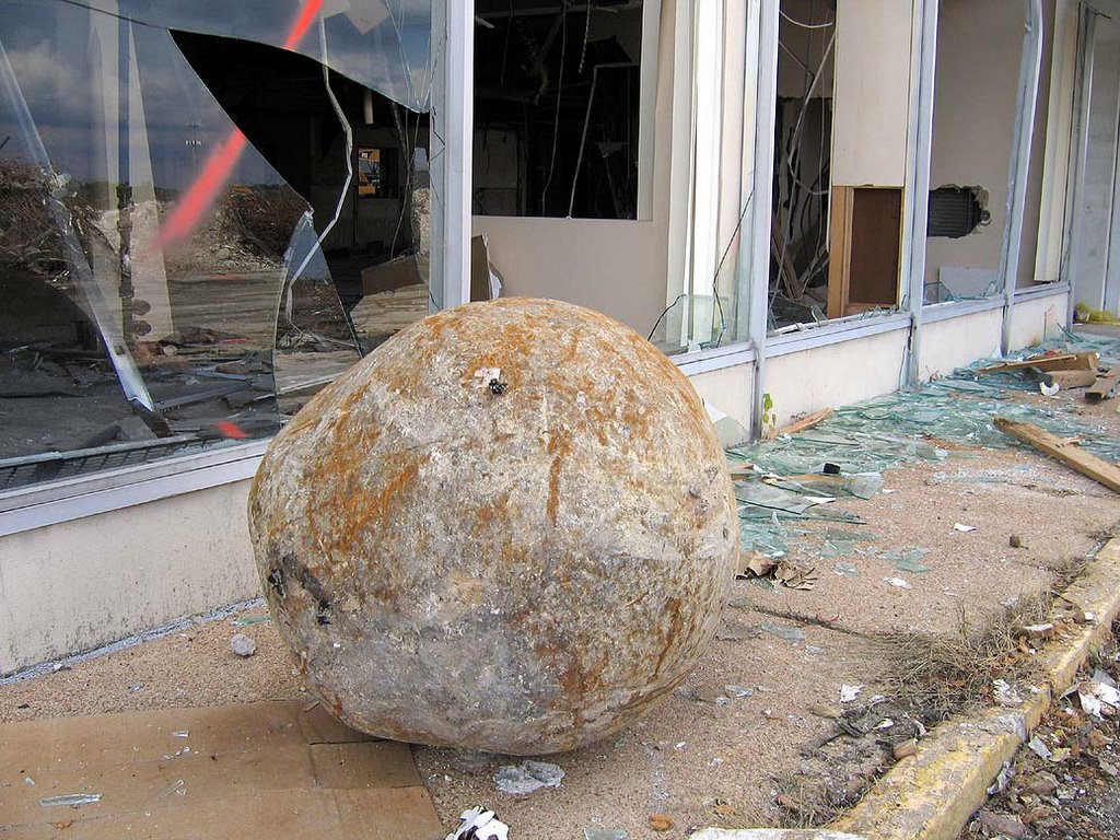
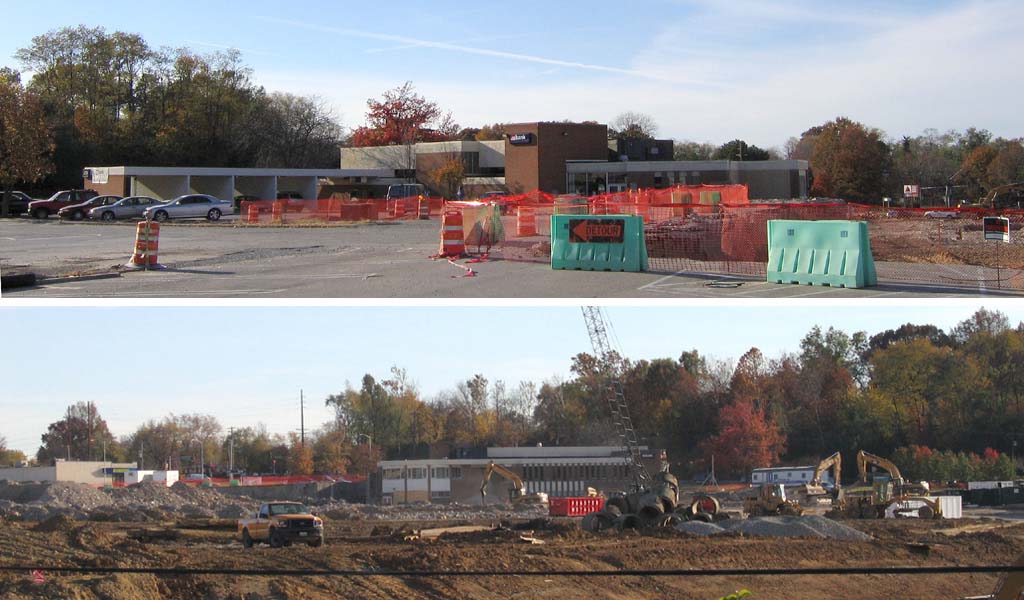
Looking west towards the Office Building (above, right) better shows the line of demarcation. I’m standing on the fresh ground near the border of debris. Construction-wise, earth moving is a budget killer. It’s often wiser – both financially and ecologically – to build with the land then to rearrange it (as in the original 1950s construction). But when “recycling” this property, they recycled parts of the building as their in-fill, and only had to pay for enough new dirt to ice over it. That’s a large budget relief. Plus, it’s also cheaper to build single-level dry wall & brick boxes. So, this does highlight why developers are constantly looking to scoop up previously built-up land for their new enterprises: huge savings.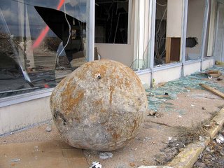 OK, I admit that I was slightly annoyed to see the Office Building still standing. It just prolongs my agony, drags all this out far too long. But the medicine ball had been moved into place (above), so they’d be gettin’ busy on the Office any day now.
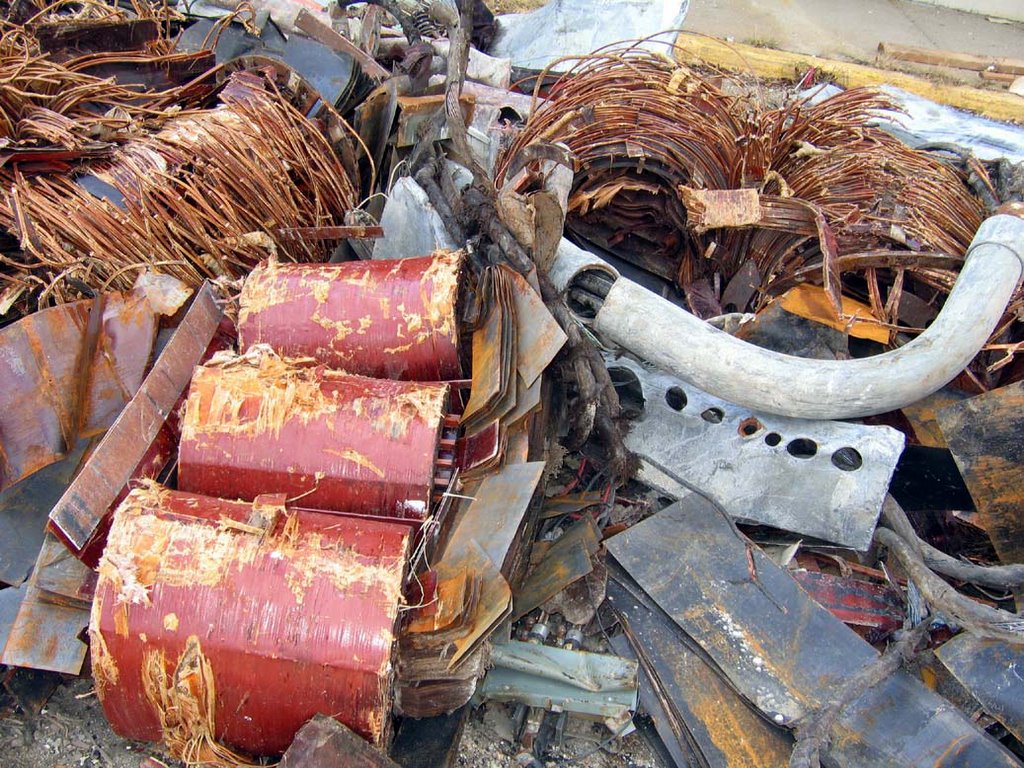
 Here’s a still-life (above) of newly-yanked Office debris. I call it “Mid-Century Electronica.”
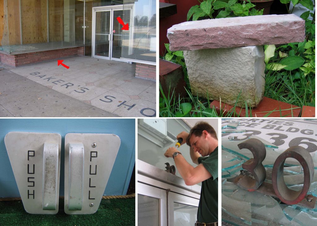
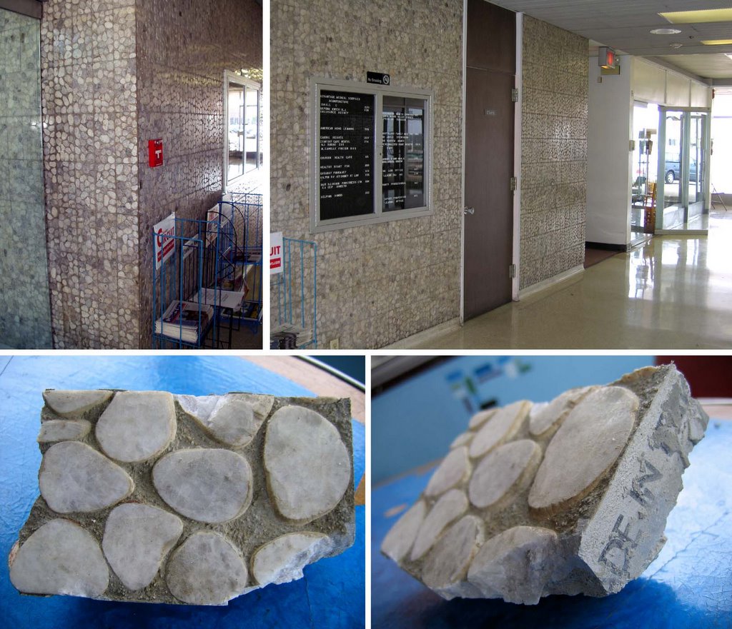
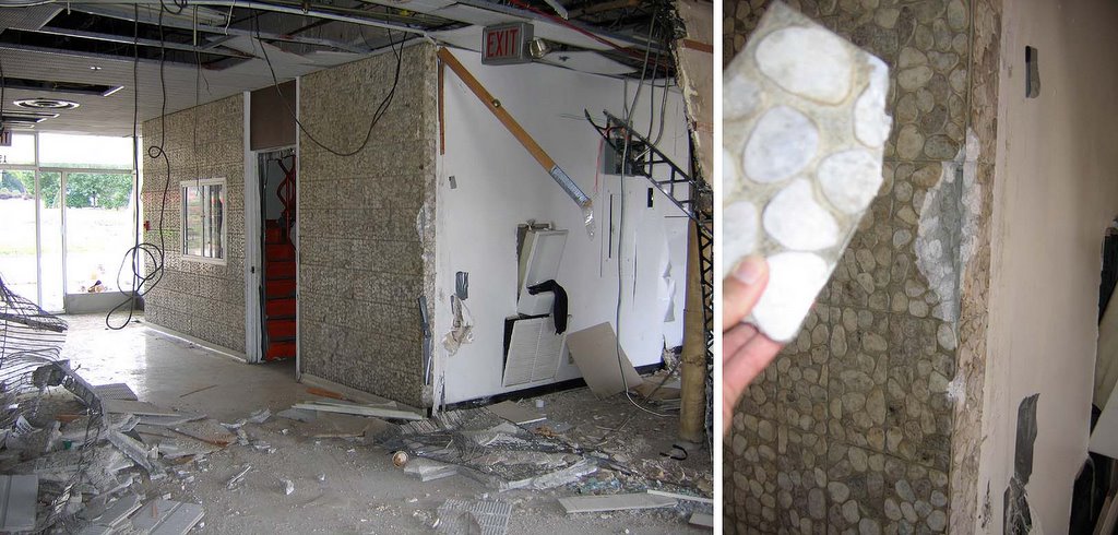
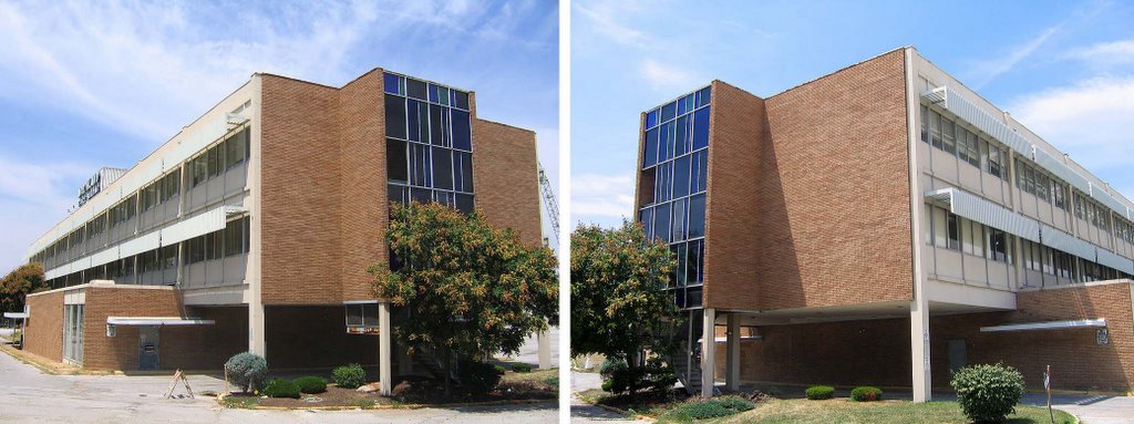
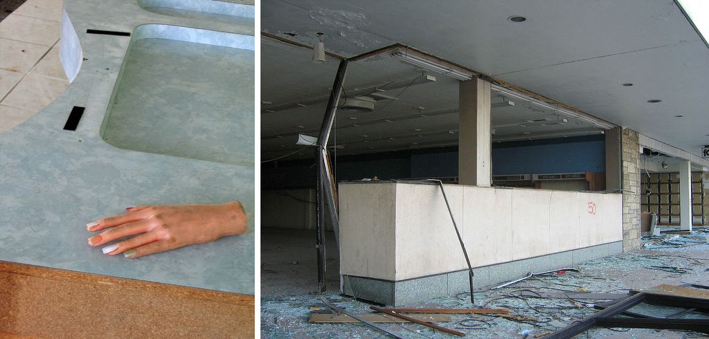
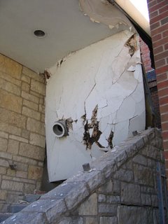
 Knowing the ball would be swinging, I went back inside the Office Building to find a souvenir. The lobby (above, left) always had the crazy sophisticate marble mosaic tile, and the chunk that fell off the corner (above, right) was laying there for me to cart off.
And as I gathered loot, a fellow scavenger walked in. Earlier in this visit, I’d noted a man (and his pick-up truck) moving about the large piles of building debris on (what remained of) the upper-level Actually, I’ve seen a lot of these types; they’re probably rooting for copper. Since no one has every truly guarded the site (I’ve stared right at Jennings’ cop cars as they drove past me, and just kept going), so why not retrieve anything of monetary value?
On this day, as I photographed from the pit and he surveyed trash piles above, we visually acknowledged one another, and kept going. Later, as I sifted through the dislodged junk inside the Office Building, I heard him walk in, talking on a cell phone. Again, we made eye contact and casually went about our business, which was an oddly comforting form of corpse communion.
 And here’s what (finally) became the very final shot of the Northland Office Building.
November 9th, 2005
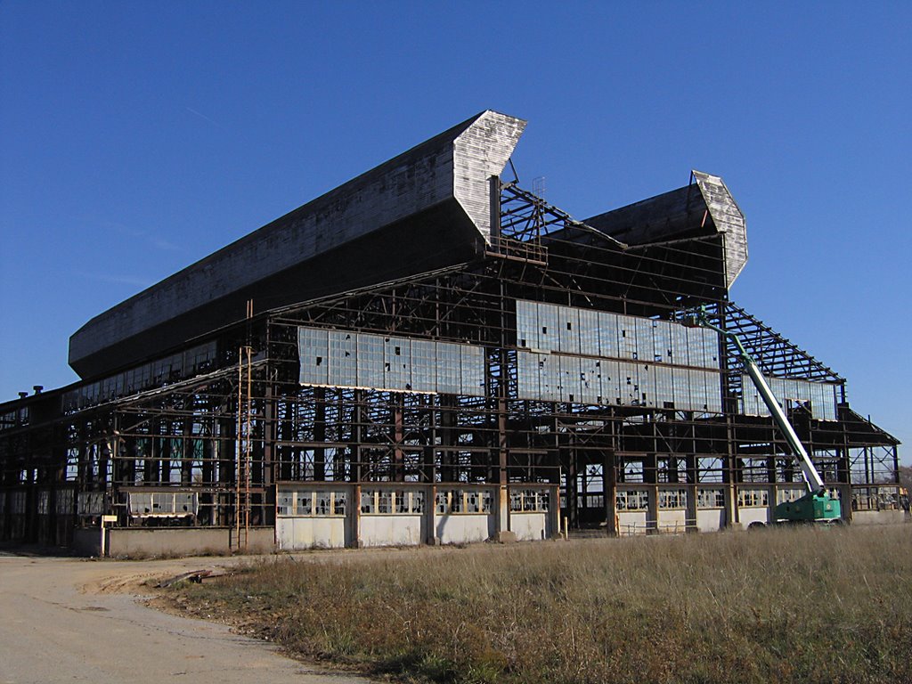
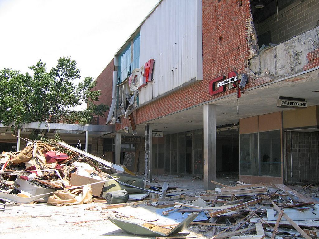
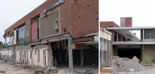
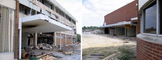
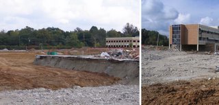
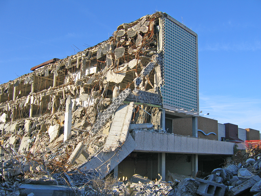
 Almost 3 weeks later, the Office Building is now thoroughly gone (above).
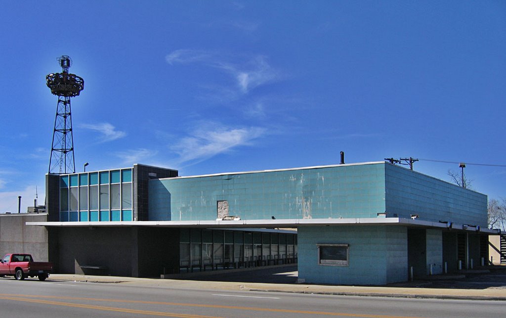
 The bank building finally becomes a stand-alone “out lot.” It’s odd that this building survives; it was the last bit to be tacked onto Northland, and then the Last Mohican. But money talks, and this place remains defiantly open.
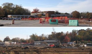 From the upper-level (above, top), it’s shocking how much space the bank actually took up within the complex. But when viewed (above, bottom) from the northern-most end of the property (I’m standing on the train tracks for this shot), the bank just looks sad and misshapen when divorced of context.
And my physical work at Northland is basically finished. I’m relieved.
There’ll be 2 more posts about it: the memorabilia I carted off; friends old and new who joined me during this odyssey along with commentary and memories from those who loved the place just as much as me. Until that time…
Miniature Memorial To The Northland Office Building
 As a kid, I mentally referred to the place as “The Marcus Welby, M.D. building,” and it always reminds me of Flipper.
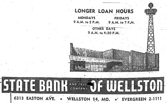
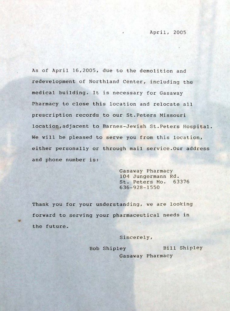
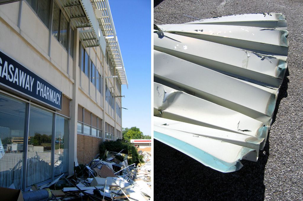
To keep me occupied while in the waiting room, Conine bought me a Flipper coloring book, which was purchased at Kresges, on our way to her doctor appointment. I colored in about 3 or 4 pages before asking the receptionist if I could have the key to the restroom. I took the coloring book with me (why?!) , and didn’t realize I’d obviously left it in the bathroom until many hours later. The Gasaway Pharmacy had been on the 1st floor from the very beginning to the very end, and never once remodeled. Their goodbye note is above (click on photo to read a larger version), and note that it was composed on an old-fashioned typewriter.
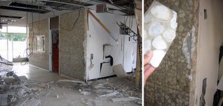
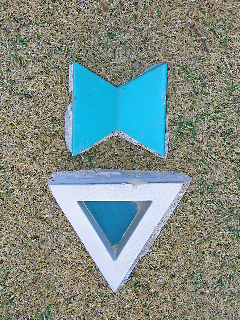 Above is what I was able to take with me, and the gathering of just these 2 pieces was accompanied by a constant hissing of “shit, shit, shit, shit, SHIT!”
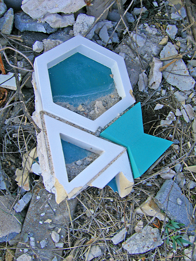 But this is the kind of stuff I had to walk away from! Look, a section still intact enough to get the full picture of how they puzzle-pieced the facade together. It’s sublime! And take a look at that hexagon piece. Dozens of them are lying – intact – all over the ground, looking like MCM birdbaths. I was losing my mind at how much stuff survived the fall, and how little I could save. That piece shown above? Way too heavy for me to carry that far by myself in heels….shit, shit, shit, shit, SHIT!!!!